
Carte topographique Louisville
Carte interactive
Cliquez sur la carte pour afficher l’altitude.
Louisville
Une grande partie de Louisville se situe sur une large plaine inondable et est entourée par des collines. Cette plaine fortement marécageuse fut drainée pour permettre à la ville de s'étendre. Dans les années 1840, la plupart des ruisseaux furent canalisés afin de prévenir tout risque d'inondation et pour éviter les épidémies. Les zones situées à l'est de l'Interstate 65 se trouvent en dehors de la plaine alluviale et sont jalonnées de collines. L'altitude varie en moyenne entre 140 et 175 m autour de la ville. La partie la plus au sud du comté de Jefferson est très peu développée. Cette région qui se nomme Knobs region accueille la Jefferson Memorial Forest.
À propos de cette carte
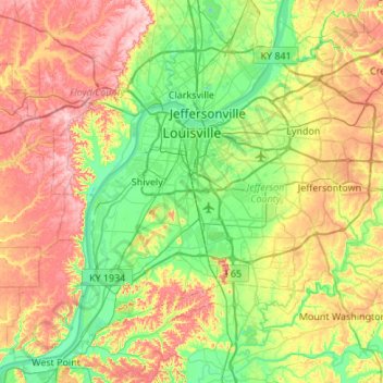
Nom : Carte topographique Louisville, altitude, relief.
Altitude moyenne : 188 m
Altitude minimum : 114 m
Altitude maximum : 306 m
Autres cartes topographiques
Cliquez sur une carte pour visualiser sa topographie, son altitude et son relief.